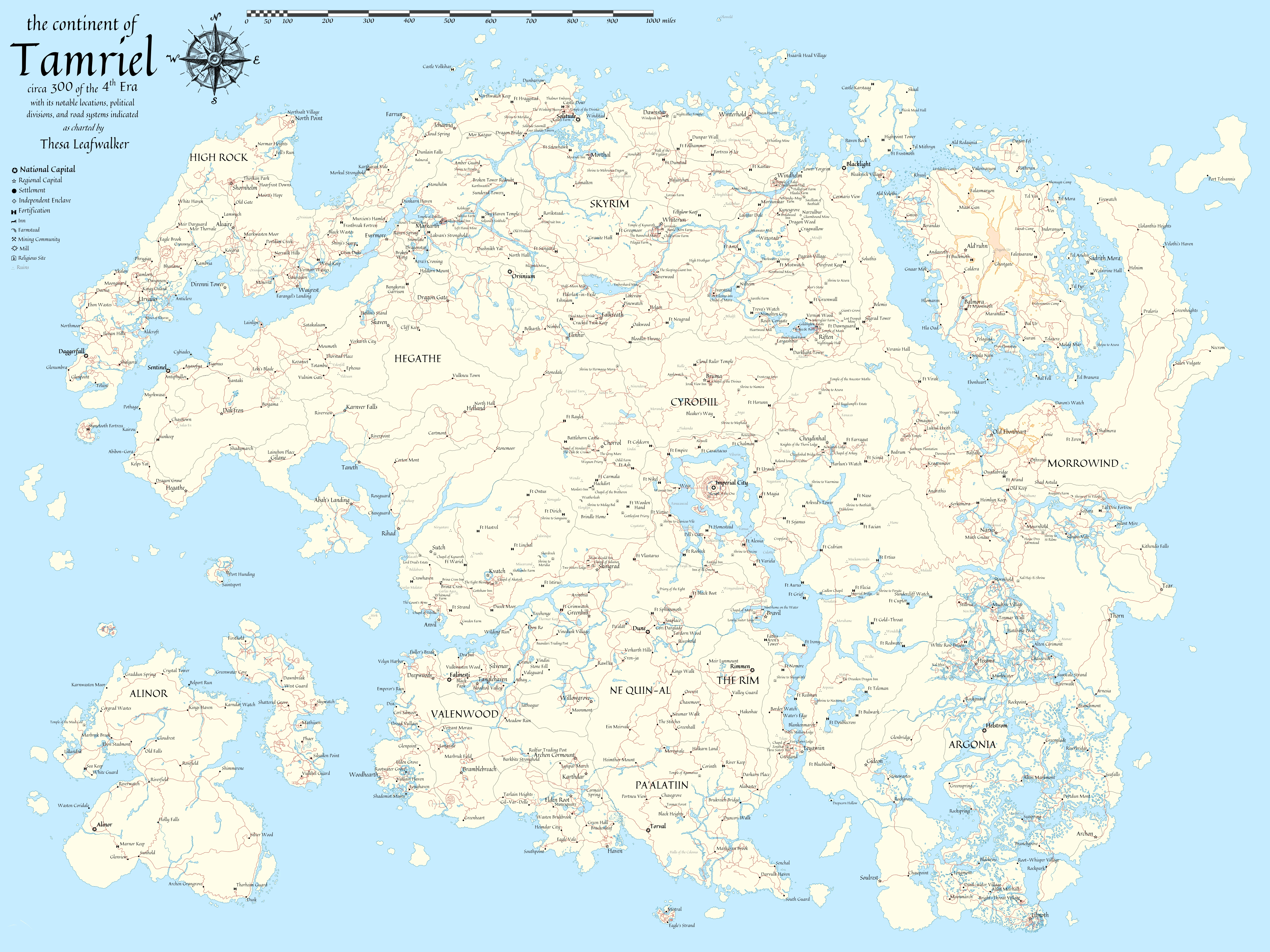
Tamriel map

Image information

Added on

Uploaded by

z993126

About this image

Map compiling roadways and almost all significant, named, in-lore cities and most Dwemer and Ayleid ruins.  (Also roughly 4 personal additions from my D&D game.)

  • There wasn't enough room for Black-Briar Lodge in the Rift in Skyrim.
  • There wasn't enough room for Twilight Temple in High Rock.
  • Insufficient data to place Mir Corrup in Cyrodiil.
  • Insufficient data to place Artemon in Cyrodiil.
  • Road data in Vvardenfell, Cyrodiil, and Skyrim mostly from the Elder Scrollls III, IV, and V.
  • Additional road data merged from Elder Scrolls Online maps.

9 comments

  1. maxito367
    maxito367
    • member
    • 0 kudos
    this is awesome, but just because I have OCD: you are missing Vahtacen (labeled as a cave in-game for some reason) and Abagarlas (actually the deepest part of Sideways Cave, on the northeastern end of the City Isle)
  2. zreee
    zreee
    • member
    • 2 kudos
    Year 300 ?
  3. daisukeXD
    daisukeXD
    • member
    • 0 kudos
    thank you
  4. Any chance you could upload an .svg version of this?
  5. EnderWolf1013
    EnderWolf1013
    • premium
    • 0 kudos
    Sorry for the question, but what did you use as a source for your waterways? I'm curious about markarth's placement. thank you for this!
  6. Yellowbird11
    Yellowbird11
    • premium
    • 110 kudos
    Excellent Work, highly appreciated!

    Always wondered why nobody ever made one of those.
  7. jaerofthelake
    jaerofthelake
    • premium
    • 43 kudos
    Thank you for the map.

    It's the best one I saw.

    Great work

  8. suciredor
    suciredor
    • member
    • 2 kudos
    AMAZING!
  9. Ashnur
    Ashnur
    • premium
    • 296 kudos
    Very cool! Thanks for the share!